

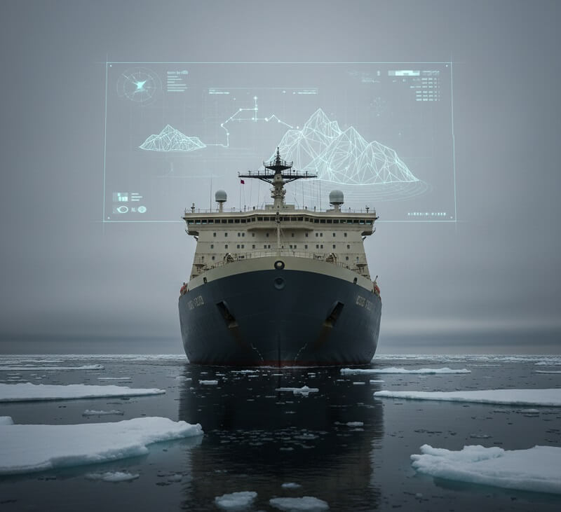
Arctic shipping routes are no longer a distant speculation. Climate change has opened longer seasonal windows across the Northern Sea Route and Northeast Passage, and global shipping operators are moving fast to capitalize on shorter transit times between Asia and Europe. The problem is stark: these waters remain among the most dangerous on the planet. Shifting ice fields, whiteout sea fog, sub-zero temperatures, and near-zero emergency response infrastructure make traditional navigation methods inadequate. AI-powered navigation systems for Arctic shipping corridors are filling this gap — not as experimental tools but as operational platforms being deployed aboard commercial and research vessels today.
From Russia’s integrated digital route-planning ecosystems to Chinese real-time ice monitoring systems and Australian climate-tech partnerships aboard expedition cruise ships, the technology landscape is diverse and advancing rapidly. The vessel route optimization AI market is valued at $1.7 billion and growing at 12.5% annually, driven by regulatory emissions pressure, autonomous shipping investment, and the raw demand for safer polar operations. Understanding which platforms are available, what they cost, and what they actually deliver is essential for fleet operators, maritime authorities, and logistics planners building Arctic-capable operations.
Why Standard Navigation Systems Fail in Arctic Conditions
Conventional electronic chart display and information systems (ECDIS) were designed for open-ocean and coastal routing where chart data is dense, weather patterns are well-modeled, and hazards are fixed. The Arctic violates every one of those assumptions. Ice fields shift within hours, fog can drop visibility below one kilometer for days, and the accuracy of bathymetric charts in polar regions remains far below what commercial navigation demands.
Studies on Arctic maritime accidents consistently point to three compounding factors: inadequate real-time ice data, poor visibility forecasting, and the absence of local weather modelling granular enough for route-level decisions. Research into navigational accidents in the Northeast Passage found that collision and grounding incidents occur up to 88% more frequently when visibility drops below one kilometer — a condition that sea fog in polar regions delivers with alarming regularity. AI systems specifically built for Arctic environments solve these problems by fusing satellite imagery, onboard radar, weather models, and historical ice-track data into a single predictive layer that updates continuously.
The shift from static chart-based planning to real-time AI-driven operational awareness is not incremental — it is structural. Arctic-specific platforms treat ice as a dynamic entity rather than a fixed obstacle, model fog formation before it occurs, and generate routing recommendations that a conventional ECDIS system cannot compute.
CHIONE and Russia’s Northern Sea Route Digital Infrastructure
Russia controls the Northern Sea Route and has set an ambitious target of 200 million tons of cargo throughput by 2030. Achieving that figure demands year-round navigation capability, which in turn requires accurate forecasting of ice movement rather than reactive responses to ice conditions already encountered. Two major developments define Russia’s AI approach to this problem.
The Unified Platform for Digital Services represents the backbone of Russia’s Arctic maritime digitization strategy. This ecosystem integrates real-time navigational, hydrometeorological, and environmental data to synchronize logistics and traffic control across the entire Northern Sea Route corridor. Operators using the platform gain access to a synchronized data environment covering vessel positions, ice charts, and weather conditions — the kind of integration that reduces the planning cycle from days to minutes.
Running parallel to this infrastructure effort is CHIONE, an AI ice forecasting system developed by the Skolkovo Institute of Science and Technology in collaboration with the Shirshov Institute of Oceanology. Named after the Greek goddess of snow, CHIONE was unveiled in Moscow in November 2025. The system uses open-source AI models to generate 72-hour forecasts of ice concentration, drift patterns, and thickness along the Northern Sea Route. According to Vladimir Vanovsky of the Skoltech AI Center, the calculations are significantly faster and more accurate than conventional meteorological methods — a claim backed by validation runs comparing CHIONE outputs against observed ice conditions over multi-year datasets.
RouteView 2.0: Real-Time Ice and Fog Intelligence for the Northeast Passage
While Russian systems concentrate on the Northern Sea Route, Chinese researchers at the Northwest Institute of Eco-Environment and Resources — part of the Chinese Academy of Sciences — have focused their efforts on the adjacent Northeast Passage. Their RouteView 2.0 platform addresses the core limitation that plagued first-generation AI route planning systems: reliance on static, coarse-resolution data that cannot capture the dynamic behavior of Arctic ice fields at the operational scale.
RouteView 2.0 uses MODIS and Synthetic Aperture Radar satellite imagery processed through big data pipelines to perform real-time monitoring of individual ice floes at a resolution of 250 meters. That level of granularity is a step change from previous systems that worked at resolutions of one kilometer or more — far too coarse for a vessel captain making route decisions around real ice obstacles.
The fog forecasting module integrates the Polar Weather Research and Forecasting model to simulate sea fog formation ahead of a vessel’s position. The system assesses liquid water content and atmospheric extinction coefficients to generate real-time visibility warnings. Beyond environmental sensing, RouteView 2.0 incorporates digital twin technology that produces an immersive three-dimensional representation of the navigational environment. Captains can visualize hazards including sea spray icing — which can destabilize a vessel rapidly — before those conditions materialize, creating a planning window that did not exist with conventional bridge systems.
Autonomous Arctic Vessels: From Decision Support to Crew-Free Operations
The technology conversation around Arctic corridors has moved beyond navigation assistance for crewed ships. The question now is whether autonomous vessels can operate safely in polar conditions without any crew aboard, and under what conditions the risk calculus favors removing humans from the equation entirely.
A study published in the journal Heliyon examined the feasibility of autonomous ships in Arctic pendulum transport modes using a function-triggered framework. The research found that Degree Three autonomous vessels — capable of operating without onboard crew under defined conditions — align with evolving international safety standards and actually present higher risk acceptability than traditional crewed ships on certain Arctic routes. The logic is straightforward: eliminating crew exposure to polar weather, structural ice impact, and emergency evacuation conditions removes a significant category of risk entirely. The study also identified persistent gaps, including regulatory inconsistency across jurisdictions and the potential for excessive workload on personnel in Remote Operation Centres managing multiple autonomous vessels simultaneously.
Physical demonstrators are already moving beyond simulation. Russia’s Breeze unmanned surface vehicle, developed by Sea Project and Unmanned Logistics, completed an experimental delivery voyage from Arkhangelsk to the Solovetsky Islands. The vessel carried up to 500 kilograms of cargo and spent over 90% of its 21-hour journey in fully autonomous mode. The project’s stated goal is to make the Arkhangelsk Region the first territory in northern Russia to use unmanned vessels for regular logistics resupply — freeing crewed icebreakers and cargo ships for more complex transits deeper into the Arctic.
NATO’s Arctic Sentry program, announced in early 2026, represents the defense dimension of the same technology. Building on lessons from Baltic Sentry maritime surveillance operations, Arctic Sentry deploys maritime autonomous systems as sensor nodes in a distributed detection and attribution architecture. AI-driven data fusion tools process continuous streams from unmanned surface vehicles, manned patrol aircraft, and satellite assets to identify anomalous vessel behavior — loitering near undersea infrastructure, erratic navigation patterns, or under-flagged vessels operating in sensitive corridors.
IceNet and the British Antarctic Survey Approach
Outside the commercial shipping sector, the British Antarctic Survey and its research partners developed IceNet — an AI sea-ice forecasting tool that predicts sea ice concentrations with accuracy levels of up to 97% one week in advance. When integrated into an autonomous navigation system, IceNet forecasts allow vessels to pre-plan Arctic routes based on probabilistic ice maps rather than the deterministic (and often incorrect) ice charts that have historically defined polar passage planning.
The IceNet architecture is particularly relevant for expedition cruise operators and scientific research vessels operating in regions where satellite revisit times and ground-truth data are sparse. Its open-source foundation also positions it as a building block for national hydrographic offices and port authorities developing their own Arctic traffic management systems — a priority as cargo volumes on northern routes increase and the demand for traffic coordination infrastructure grows.
International Collaboration and Standardization Efforts
One of the structural challenges facing Arctic AI navigation is fragmentation. Russian, Chinese, South Korean, Australian, and European systems have been developed independently, with different data standards, regulatory frameworks, and interoperability assumptions. A voyage on the Northern Sea Route may involve a vessel equipped with Norwegian ECDIS, ice charts from a Russian government platform, weather data from a European meteorological service, and route optimization from an Australian or Chinese commercial platform. Getting those systems to communicate coherently is not a software problem — it is a standards problem.
South Korea’s Korea Research Institute of Ships and Ocean Engineering and Canada’s National Research Council took a concrete step toward resolving this by signing a Memorandum of Understanding to collaborate on polar-operating vessel technologies and AI-driven autonomous ship standards. The agreement targets global Arctic technology standardization — the precondition for interoperable safety systems across vessels from different flag states navigating the same corridors.
Aurora Expeditions represents the commercial sector’s contribution to both data quality and route safety. The operator partnered with Australian climate-tech firm CounterCurrent to integrate an AI-powered navigation system aboard the expedition vessel Douglas Mawson for its Antarctic season. The system uses onboard sensors to capture real-time wind, wave, and ocean current data, feeding this into global climate models while simultaneously generating hyper-local route predictions that allow the ship to exploit rather than resist prevailing currents. As Aurora’s sustainability manager Sasha Buch noted, real-time data in polar regions is critically scarce — the company’s data collection serves both immediate navigation and the long-term scientific picture that other operators will eventually depend on.
Top AI Navigation and Maritime Intelligence Platforms for Arctic and Polar Operations
The following platforms represent the leading commercially available systems used for AI-powered maritime navigation, route optimization, vessel tracking, and polar operations management. Each entry covers what the platform does, who it is designed for, its pricing, and where it fits in an Arctic-capable maritime technology stack.
Kongsberg Maritime K-Bridge / K-NAV
Kongsberg Maritime’s K-Bridge integrated bridge system and K-NAV navigation suite represent the high-end commercial standard for offshore and Arctic-capable vessels. The platform integrates certified RADAR, ECDIS, autopilot, and multi-function navigation displays into a unified bridge environment that meets IMO/SOLAS and flag state statutory requirements. K-Bridge is deployed on icebreakers, offshore supply vessels, and research ships operating in polar regions, where its dynamic positioning integration and sensor fusion capabilities make it the most complete bridge solution for genuinely demanding Arctic operations. The system supports Kongsberg’s broader autonomous vessel program, which includes remote and unmanned operation modes relevant to the Arctic autonomous shipping discussion. On the downside, the platform is purpose-built for large commercial vessels and is neither accessible to smaller operators nor priced for mid-market fleets. Pricing is enterprise-only and obtained directly from Kongsberg through a commercial engagement — no public rates are published.
- IMO/SOLAS type-approved ECDIS and RADAR integration
- Dynamic positioning support for offshore and polar operations
- Compatible with Kongsberg’s autonomous vessel architecture
- Sensor fusion across bridge systems and onboard instrumentation
- Used aboard icebreakers and polar research vessels
MarineTraffic (Kpler)
MarineTraffic is the most widely recognized vessel tracking and maritime intelligence platform globally, now operated under Kpler following its 2023 acquisition. The platform combines terrestrial and satellite AIS networks to deliver real-time vessel positions, port-call history, fleet management tools, and voyage analytics across commercial shipping operations worldwide. For Arctic route planners and logistics coordinators, MarineTraffic’s vessel positioning data provides a baseline operational picture — knowing where ships are, their last known position in remote corridors, and historical track data for route analysis. The acquisition by Kpler has moved pricing toward enterprise tiers, with API access now sold through direct sales engagement. The publicly available web plans run from a Basic tier at approximately £10/month covering 10 vessels, an Essential plan at £100/month for single-vessel deep analytics, and an Enterprise tier with unlimited vessels and five years of track history priced on request. The platform excels at breadth and data depth but is not a dedicated polar route optimizer — it provides the positioning intelligence layer that feeds into optimization workflows.
- Global terrestrial and satellite AIS vessel positioning
- Port call analytics and fleet management dashboards
- Historical track data back to 2010 (190-day API lookback)
- Real-time weather map overlay subscriptions available
- API access for integration into custom maritime analytics platforms
VesselFinder
VesselFinder offers a strong alternative to MarineTraffic at more accessible price points, with global AIS coverage that has improved significantly through satellite investment. The platform suits mid-market buyers who need reliable global vessel tracking without the full analytics weight of an enterprise system. For Arctic corridor monitoring, the Satellite plan provides real-time global coverage including remote ocean areas, 90-day track history, and monitoring of up to 2,000 vessels in a custom fleet — at pricing that requires direct contact for commercial tiers. The Premium terrestrial plan (which covers only coastal range vessels) is available publicly, though exact current pricing for Satellite and enterprise tiers requires a quote. VesselFinder subscriptions do not auto-renew, and API access is sold separately from web plans. The platform does not natively offer ice routing or polar-specific forecasting — it functions as the vessel awareness layer in a broader Arctic navigation stack. For operators needing route prediction, ice forecasting, or autonomous vessel management, VesselFinder is a complement to rather than a replacement for dedicated polar AI systems.
- Global satellite and terrestrial AIS coverage
- Route prediction tools on Satellite subscription tier
- Fleet monitoring for up to 2,000 ships
- Port call tracking and vessel utilization analytics
- No automatic renewal — subscriptions managed manually
Windward Maritime AI
Windward operates as the leading maritime AI platform for risk, compliance, and predictive intelligence — serving governments, financial institutions, large cargo owners, and freight forwarders. The platform’s core capability is AI-driven behavioral analysis of vessel movements: identifying dark shipping patterns, sanctions evasion behavior, spoofed AIS signals, and anomalous loitering that signals potential infrastructure interference. In the Arctic context, Windward’s anomaly detection layer is relevant for national authorities and port operators monitoring increasingly congested northern corridors where under-flagged and non-compliant vessels represent both a safety and security risk. The platform goes beyond standard AIS tracking to model why vessels are behaving the way they are — a meaningful distinction when dealing with Arctic corridors where commercial and strategic interests increasingly overlap. Pricing is enterprise-only and not publicly listed; contact Windward directly for commercial terms applicable to government and large fleet operations.
- AI behavioral analysis and anomaly detection across global vessel movements
- Dark shipping, sanctions evasion, and AIS spoofing detection
- Predictive visibility for cargo owners and freight forwarders
- Government and compliance-grade risk scoring
- Integration with port authority and naval intelligence workflows
Navionics (Garmin)
Navionics, now owned by Garmin, is the most widely used marine charting application globally — primarily serving recreational and light commercial operators rather than heavy commercial Arctic shipping. The app operates on a subscription model, with US and Canada annual access priced at $49.99/year through the mobile app, covering lakes, rivers, and coastal marine charts. For Arctic and polar commercial operations, Navionics falls short of SOLAS compliance requirements and is not type-approved for ECDIS use on commercial vessels over 500 gross tons. Its value in the Arctic navigation context sits at the operator-level planning and reconnaissance phase — crew members and expedition guides use it for orientation and route familiarization before transitioning to type-approved systems for operational navigation. The SonarChart feature provides crowdsourced depth data that is genuinely useful in shallow coastal Arctic areas where official hydrographic data is sparse, though this data should be treated as supplementary rather than authoritative in polar operations.
- Annual mobile app subscriptions from $49.99/year (US and Canada)
- SonarChart crowdsourced depth data for shallow coastal waters
- Dock-to-dock navigation and route planning tools
- Offline chart downloading for areas with no connectivity
- Not SOLAS type-approved for commercial vessel ECDIS requirements
DeepSea Technologies
DeepSea Technologies operates a maritime AI platform focused on voyage optimization, weather routing, CII (Carbon Intensity Indicator) rating improvement, and shipping decarbonization — a set of capabilities directly relevant to Arctic route efficiency and regulatory compliance. Arctic operators face specific CII pressure because longer routes through challenging sea states burn more fuel, and optimization that squeezes fuel consumption through current-assisted routing and ice-avoidance planning directly improves a vessel’s emissions rating. DeepSea connects vessel performance data to route recommendations, allowing fleet managers to compare planned versus actual voyage efficiency and identify correction opportunities. The platform serves bulk carriers, tankers, and container vessels, with pricing structured around fleet size and feature access — commercial terms are obtained directly from DeepSea rather than published publicly.
- AI voyage optimization and weather routing for commercial fleets
- CII compliance tracking and improvement recommendations
- Vessel performance benchmarking against route conditions
- Current-assisted routing for fuel efficiency in polar seas
- Fleet-wide analytics dashboard with planned versus actual reporting
AXSMarine
AXSMarine is a maritime software and data provider built for commercial shipping and commodity markets, delivering chartering intelligence, market insights, trade flow analytics, and raw AIS data via API. For Arctic route planners operating in commercial shipping contexts — tanker operators, bulk carriers moving LNG or ore from Russian Arctic terminals, or freight forwarders building cargo strategies for Northern Sea Route transits — AXSMarine provides the market intelligence layer that complements operational navigation systems. The platform’s API integration is particularly valuable for teams that want to pipe maritime data into their own analytics models rather than consume it through a fixed dashboard. Pricing is quote-based and scoped to the data modules required — there is no published pricing, and commercial terms are negotiated directly with AXSMarine’s sales team.
- AIS, vessel, and voyage data via API for custom analytics builds
- Chartering and market intelligence for commercial shipping decisions
- Trade flow analysis for Arctic and global corridor planning
- Historical voyage data for benchmarking and route analysis
- Suitable for commercial teams embedding maritime data in proprietary models
Spire Maritime
Spire Maritime — now part of the Kpler group following acquisition — operates the largest proprietary satellite AIS constellation in the maritime intelligence market, with over 100 nanosatellites providing global vessel tracking coverage including remote Arctic and Antarctic waters where terrestrial AIS reception is non-existent. For operators navigating beyond coastal AIS range into deep Arctic waters, Spire’s satellite coverage is one of the few sources of real-time vessel positioning data. The platform also delivers weather intelligence and routing support, making it relevant for polar expedition planning and commercial Arctic transit monitoring. Post-acquisition pricing has moved to enterprise-focused tiers with reduced self-serve flexibility; commercial terms are negotiated directly with the Kpler-Spire sales organization. Spire’s APIs are used by shipping companies, port authorities, maritime insurers, and government agencies building position-aware operational systems.
- 100+ nanosatellite constellation for global AIS coverage including polar regions
- Weather intelligence and routing data for remote maritime operations
- API integration for custom fleet tracking and analytics applications
- Used by ports, insurers, and shipping companies globally
- Enterprise pricing — contact Kpler-Spire for commercial terms
SeaVantage
SeaVantage is a voyage optimization and ocean intelligence platform that focuses on predictive port arrival and container ETA accuracy — a capability set that is increasingly relevant to Arctic corridor commercial planning as cargo volumes on northern routes grow. The platform layers historical dwell data, port congestion analytics, and weather routing on top of AIS positioning to generate ETAs that account for realistic delays rather than straight-line projections from last known position. For Arctic logistics coordinators managing time-sensitive cargo moving between Asian and European ports via northern routes, SeaVantage provides the ETA intelligence that bridges vessel position awareness and supply chain planning. The platform targets container operators, freight forwarders, and logistics teams. Pricing is not publicly listed and is obtained through SeaVantage directly.
- Predictive port arrival and container ETA with congestion modeling
- Weather routing integrated with voyage planning workflows
- Historical dwell and port performance analytics
- Designed for container operators and logistics coordinators
- Particularly strong for Asia-Europe ocean corridor planning
ocean.ai
ocean.ai turns oceanographic and weather data into operational predictions and reporting layers specifically designed for maritime navigation decision-making. The platform focuses on producing audit-ready voyage records — quantifiable route outputs tied to specific weather, wave, and current conditions — which serves both operational navigation and the compliance documentation demands facing commercial operators under CII and emissions frameworks. For Arctic route planning, ocean.ai’s ability to convert complex environmental data into traceable route decisions is particularly valuable given the regulatory scrutiny that polar operations attract. Pricing is not publicly disclosed; contact ocean.ai directly for commercial terms based on fleet size and operational scope.
- Oceanographic and weather data converted to operational route predictions
- Audit-ready voyage reporting for compliance and emissions documentation
- Constraint-linked voyage planning tied to specific environmental conditions
- Supports CII and emissions baseline versus variance reporting
- Designed for commercial operators needing traceable, documented navigation decisions
Pricing Comparison Across AI Maritime Navigation Platforms
The cost of AI navigation capability in Arctic shipping varies dramatically by use case and scale. At the accessible end, Navionics provides mobile charting for $49.99/year — suitable for expedition crew orientation but not commercial vessel compliance. MarineTraffic’s web plans start at approximately £10/month for basic vessel tracking and scale to enterprise rates for full API and satellite integration. VesselFinder follows a similar tiered structure with Satellite coverage pricing available on request for commercial tiers. The specialist platforms — Kongsberg, Windward, Spire, DeepSea, AXSMarine, SeaVantage, and ocean.ai — operate exclusively on enterprise pricing models with no public rate cards, reflecting the custom integration, regulatory compliance overhead, and operational support demands of commercial Arctic deployments. For fleet operators building a complete Arctic navigation stack, the practical cost combines a type-approved ECDIS bridge system, a satellite AIS positioning layer, a weather and ice routing application, and a compliance reporting tool — each typically sourced from different vendors and priced separately through direct commercial engagement.
How to Choose the Right AI Navigation System for Arctic Operations
The first decision is regulatory scope. Commercial vessels over 500 gross tons operating on international voyages require SOLAS-compliant, type-approved ECDIS systems. That immediately limits the field to platforms certified by recognized flag state authorities — Kongsberg K-Bridge, Wärtsilä’s NACOS Platinum, and a handful of comparable enterprise bridge systems. Expedition operators and research vessels working in the recreational and light commercial sector have more flexibility but should still prioritize platforms that integrate polar-specific weather and ice data rather than relying on general-purpose coastal navigation applications.
The second criterion is ice data integration. Not all AI maritime platforms connect to real-time Arctic ice forecasting services. Systems that lack integration with SAR satellite feeds, MODIS ice concentration data, or dedicated polar weather models will produce routing recommendations that are dangerous in ice-infested waters. Verify that the platform ingests actual polar-environment data rather than extrapolating from general ocean conditions.
Connectivity assumptions matter enormously in polar regions. Many AI navigation platforms assume continuous internet connectivity for real-time data updates. In the Arctic, satellite communications are expensive and intermittent, and VSAT coverage at high latitudes is unreliable. Platforms that support offline operation with pre-loaded chart and ice forecast packages — and that resynchronize efficiently when connectivity is restored — are meaningfully safer than those built for always-on environments.
Autonomy level alignment is the fourth consideration. Operators moving toward autonomous or remote-operated Arctic vessels need platforms explicitly designed for maritime autonomous surface ship operations — supporting remote monitoring, remote intervention, and the regulatory documentation required by evolving MASS frameworks. General-purpose navigation software does not meet these requirements regardless of how advanced its AI routing capabilities are.
Finally, consider data ownership and export. In commercial Arctic operations, voyage data is legally significant. Route records, weather conditions at decision points, and positioning data may be required for insurance claims, incident investigations, and regulatory audits. Platforms that lock voyage data in proprietary formats or restrict export should be assessed carefully before deployment in high-stakes polar environments.
Pro Tips for AI-Assisted Arctic Navigation
Never rely on a single data source for ice assessment. The most capable AI systems fuse SAR satellite imagery, optical satellite data, and onboard radar into a composite ice picture. Each source has failure modes — optical satellites are blind in cloud cover, SAR misses thin ice at certain incidence angles, and onboard radar has a limited horizon. The system’s reliability comes from cross-referencing all three, not from any individual sensor alone.
Treat AI route recommendations as high-quality starting points, not final decisions. The best polar navigation systems present crew with recommended corridors and hazard assessments, not binary route instructions. Captains and ice navigators with local experience will consistently outperform AI systems in edge cases — the technology’s role is to expand the information available to human decision-makers, not replace their judgment.
Ice forecast accuracy degrades rapidly beyond 72 hours. Systems like CHIONE provide reliable 72-hour forecasting windows, but the accuracy of multi-day Arctic ice predictions drops substantially as dynamic weather events drive ice movement in ways that current models cannot fully capture. Plan routes using the 24-to-48-hour forecast window for operational decisions, and use longer-range forecasts only for contingency planning.
Invest in crew training for AI system outputs, not just the systems themselves. The gap in Arctic shipping incidents is frequently not the technology — it is the ability of bridge crew to interpret AI-generated hazard maps, understand confidence intervals in ice forecasts, and know when system recommendations should be overridden based on direct observation. Technical training on the software interface alone is insufficient.
Build your digital twin data proactively. Platforms like RouteView 2.0 and Mapsea Navigation 3.0 that incorporate digital twin environments become significantly more accurate when calibrated to a specific vessel’s performance characteristics — hull form, icebreaking rating, engine output, and turning radius. The time invested in feeding accurate vessel parameters into these systems before a polar voyage pays back immediately in more relevant route recommendations.
Maintain redundant connectivity options. A voyage through the Northeast Passage with a single Iridium satellite terminal is inadequately equipped for AI-assisted navigation that depends on data updates. Operators should plan for primary VSAT coverage, backup Iridium for critical navigation data, and local caching of the most recent ice and weather forecasts — updated as frequently as bandwidth allows — to cover periods of complete connectivity loss.
Document every AI-assisted routing decision and the environmental data that supported it. As Arctic shipping volumes increase and incident investigations become more scrutinized by national maritime authorities and IMO bodies, the ability to show a clear decision trail — what the AI system recommended, what data it was using, and what the captain decided — is both a legal protection and a contribution to the growing knowledge base that will make future Arctic AI systems more accurate.
Frequently Asked Questions
What is CHIONE and how does it help Arctic shipping?
CHIONE is an AI ice forecasting system developed by the Skolkovo Institute of Science and Technology in partnership with the Shirshov Institute of Oceanology. It generates 72-hour forecasts of ice concentration, drift patterns, and thickness along the Northern Sea Route using open-source AI models. The system processes data significantly faster than conventional meteorological methods, giving voyage planners a reliable short-range ice prediction window for operational route decisions on the Northern Sea Route.
What is RouteView 2.0?
RouteView 2.0 is an intelligent navigation system developed by the Northwest Institute of Eco-Environment and Resources under the Chinese Academy of Sciences. It monitors Arctic ice conditions in real time using MODIS and SAR satellite data at 250-meter resolution, integrates polar weather forecasting for sea fog prediction, and uses digital twin technology to create a three-dimensional navigational environment. It addresses the fundamental limitation of earlier systems that relied on static, coarse-resolution ice data.
Are autonomous ships safe in Arctic conditions?
Research published in Heliyon found that Degree Three autonomous ships — capable of operating without onboard crew under defined conditions — align with evolving international safety standards and present higher risk acceptability than crewed vessels on specific Arctic routes. Removing crew from polar environments eliminates a significant exposure category. Regulatory frameworks for maritime autonomous surface ships are still developing, and most current deployments involve remote monitoring rather than fully unattended operation.
What AI navigation platforms work in areas beyond satellite AIS range?
Spire Maritime operates over 100 nanosatellites providing global AIS coverage including deep Arctic and Antarctic waters beyond terrestrial AIS reception range. Kongsberg Maritime’s K-Bridge bridge system integrates onboard sensor fusion that operates independently of external connectivity. For ice forecasting in connectivity-limited environments, platforms that support offline operation with pre-loaded ice forecast packages are essential for genuine polar reliability.
What does AI Arctic navigation software typically cost?
Entry-level maritime charting apps like Navionics start at $49.99/year. Vessel tracking platforms like MarineTraffic run from approximately £10/month for basic plans to enterprise pricing for full API and satellite access. Polar-specialist platforms including Kongsberg, Windward, DeepSea, AXSMarine, and Spire are enterprise-only with no public pricing — commercial terms are negotiated based on fleet size, data requirements, and operational scope. A complete Arctic navigation stack typically combines multiple platforms and is priced accordingly.
What is digital twin technology in Arctic navigation?
Digital twin technology in maritime navigation creates a dynamic three-dimensional virtual model of the navigational environment — sea conditions, ice fields, visibility hazards, and vessel position — updated in real time from sensor and satellite data. RouteView 2.0 uses this approach to allow captains to visualize hazards like sea spray icing and impenetrable ice barriers before encountering them, extending the planning horizon beyond the vessel’s direct line of sight.
What is Mapsea Navigation 3.0?
Mapsea Navigation 3.0 is a CES Innovation Award-winning AI-driven digital twin navigation platform designed to operate across all sea routes including Arctic passages. The system integrates intelligence from over one million vessels and uses centimeter-level RTK precision positioning to deliver collision prediction, vessel-to-shore synchronization, and ESG-aligned routing that accounts for marine sanctuaries, ice boundaries, and safety contours. It is positioned as a comprehensive autonomous navigation layer rather than a single-function tool.
How does sea fog affect Arctic shipping and how does AI address it?
Sea fog in Arctic waters reduces visibility below one kilometer — a threshold at which navigational accident rates increase by up to 88% according to maritime safety research. AI systems like RouteView 2.0 address this by using the Polar Weather Research and Forecasting model to simulate fog formation ahead of a vessel’s position, assessing atmospheric liquid water content and extinction coefficients to generate real-time visibility warnings before dangerous conditions develop rather than after they are encountered.
The Path to Predictable Arctic Corridors
The technology gap that made Arctic shipping a high-stakes gamble is closing measurably. Systems like CHIONE, RouteView 2.0, and Mapsea Navigation 3.0 are delivering the real-time operational intelligence that static charts and long-range climatology could never provide. Autonomous surface vehicles are completing Arctic supply runs in fully unmanned mode. International partnerships between South Korean and Canadian research institutions are building the standards framework that interoperable safety systems will eventually require.
What remains is scale and integration. The platforms described in this article are functioning in isolation from each other — a Russian ice forecasting system, a Chinese fog prediction platform, an Australian current-optimization tool, and a Norwegian bridge system each solving a piece of the puzzle independently. The decade ahead will likely be defined by the effort to fuse these capabilities into coherent, standardized, globally interoperable Arctic navigation infrastructure. As cargo traffic along the Northern Sea Route grows toward Russia’s 200-million-ton ambition, and as climate change continues to extend the navigable season, that integration effort will shift from desirable to essential.
For maritime operators, the practical message is clear: the tools have advanced far enough that operating Arctic corridors without AI-assisted freight logistics planning and navigation support is no longer a defensible risk management position. The systems are available, increasingly affordable relative to the cost of hull damage or loss of vessel, and demonstrably more accurate than human-only navigation in the dynamic conditions that define polar waters. The question is no longer whether AI belongs in Arctic navigation — it is which combination of platforms delivers the most complete protection for the specific route, vessel type, and operational profile involved.

Loading comments…