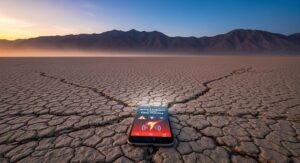
On December 4, 2025, at precisely 8:06 a.m. Pacific Standard Time, mobile phones across northern California and western Nevada buzzed with urgent notifications from the USGS ShakeAlert system. The alerts warned of a magnitude 5.9 earthquake striking just east of Dayton, Nevada, urging recipients to drop, cover, and hold on immediately. Within minutes, confusion spread as the event page vanished from the United States Geological Survey’s website, leaving residents and officials scrambling for answers. This incident marked a rare but significant glitch in one of the nation’s most advanced earthquake early warning systems, highlighting both its potential and its vulnerabilities.
The purported epicenter was pinpointed approximately 3.7 miles east of Dayton in Lyon County, at a shallow depth of about five miles. Such parameters would have indicated a seismic event capable of producing strong shaking in nearby communities, including Carson City, Reno, and Sparks. Initial reports from the USGS described the quake as occurring in a seismically active region known for its fault lines, but swift investigation revealed no corresponding seismic data. The false alarm, while causing no physical harm, underscored the importance of public trust in emergency notifications and the need for robust verification protocols.
As news outlets from Reuters to local affiliates like KCRA and KTVU picked up the story, social media platforms flooded with user reports. Many in the San Francisco Bay Area, over 200 miles away, expressed surprise at receiving alerts for an event they could not feel. Others closer to the supposed epicenter, such as in Carson City, noted the absence of any perceptible tremor. This rapid dissemination of information, followed by the equally quick retraction, amplified the event’s reach, turning a technical error into a statewide conversation about seismic readiness.
The ShakeAlert system, operational since 2019 in California and expanding to Nevada and Oregon, relies on a network of over 700 seismic sensors to detect preliminary waves from earthquakes and issue warnings before damaging shaking arrives. In this case, the system erroneously triggered alerts based on faulty data processing, a phenomenon officials described as an isolated anomaly. Investigations into the cause were underway by mid-morning, with the USGS committing to transparency in their findings to prevent future occurrences.
Despite the absence of an actual quake, the episode served as an impromptu drill for thousands, prompting many to review their emergency plans. Nevada, ranking third in the United States for seismic activity over the past 150 years, experiences hundreds of tremors annually, making such systems indispensable. The false alarm, though unsettling, provided a real-world test of response mechanisms without the chaos of genuine destruction.
Understanding the ShakeAlert System and Its Mechanisms
The USGS ShakeAlert represents a cornerstone of modern seismic technology, designed to mitigate the impacts of earthquakes in the western United States. Developed over two decades with contributions from universities like the University of California, Berkeley, and the California Institute of Technology, it processes data from ground-motion sensors to estimate an event’s magnitude and location within seconds. For a hypothetical 5.9 magnitude quake near Dayton, warnings could reach users up to 30 seconds in advance, allowing time for critical actions like pulling over while driving or securing heavy objects indoors.
At its core, ShakeAlert distinguishes between primary (P) waves, which travel faster but cause less damage, and secondary (S) waves, responsible for the destructive shaking. By detecting P waves first, the system calculates the impending threat and disseminates alerts via wireless emergency systems, apps like MyShake, and integrated services in transportation and utilities. On December 4, this finely tuned process faltered, issuing alerts without a corresponding S-wave confirmation, leading to the prompt cancellation.
Experts emphasize that such systems are not infallible; they operate in real-time under immense data pressure. Historical precedents include minor glitches during the 2021 magnitude 5.8 Ontario, California event, where alerts were slightly delayed. However, the Nevada incident stood out for its complete retraction, prompting a review of data validation algorithms. The USGS noted that the error originated in the automated detection phase, where preliminary signals were misinterpreted as a significant event.
In Nevada specifically, the Nevada Seismological Laboratory at the University of Nevada, Reno, plays a pivotal role in ShakeAlert’s operations. This facility monitors a vast network covering the Great Basin and Sierra Nevada, providing data that enhances accuracy for regional events. The lab’s involvement ensures that alerts are tailored to Nevada’s unique tectonic setting, where extension along the Basin and Range Province generates frequent, moderate quakes.
The broader implications extend to public education. While the false alarm caused momentary panic, it reinforced the message that heeding alerts—regardless of their eventual validity—can save lives. Officials from the Nevada Office of Emergency Management urged residents to treat every notification as genuine until proven otherwise, aligning with national guidelines from the Federal Emergency Management Agency.
Technological redundancies, such as cross-verification with multiple sensor arrays, are being scrutinized in the aftermath. Collaborations with private sector partners, including Google and Apple, which integrate ShakeAlert into mobile operating systems, aim to refine alert thresholds. This incident, while unfortunate, accelerates improvements, ensuring the system evolves to handle edge cases more effectively.
Public Reactions and the Spread of Information
As alerts pinged across devices, reactions varied from immediate compliance to skeptical dismissal. In urban centers like Reno, where proximity to the alleged epicenter heightened concern, social media posts captured the moment: users sharing screenshots of notifications alongside queries like “Did anyone feel that?” Platforms such as X (formerly Twitter) saw hashtags like #NevadaQuake trending regionally, with over 5,000 mentions within the first hour.
Local news stations, including KCRA in Sacramento, initially broadcast the event based on USGS feeds, only to issue corrections minutes later. This flip-flop tested the agility of media outlets, many of which pivoted to explanatory coverage on alert systems. Reuters provided a concise wire report, while the San Francisco Chronicle delved into the Bay Area’s unexpected involvement, noting how the system’s wide dissemination radius included distant populations.
Community forums and neighborhood apps buzzed with firsthand accounts. Residents in Dayton reported no shaking but appreciated the “practice run,” while others in eastern California expressed frustration over unnecessary alarms disrupting morning routines. Psychologists observing the response highlighted the “cry wolf” effect, where repeated false positives could erode trust, yet affirmed that the educational value outweighed short-term anxiety.
Government agencies responded proactively. The Nevada Division of Emergency Management activated its situation room, coordinating with local sheriffs in Lyon and Carson City counties to field inquiries. No emergency declarations were needed, but hotlines saw a surge in calls, with operators calming nerves and directing callers to official USGS updates.
Social amplification also revealed disparities in access to information. Rural areas with spotty cell service missed alerts altogether, prompting discussions on equitable warning distribution. Advocacy groups like the Earthquake Country Alliance called for expanded infrastructure, including low-frequency radio broadcasts as backups to cellular networks.
By midday, the narrative shifted from panic to reflection, with viral threads dissecting the glitch. Influencers and local experts weighed in, turning the mishap into an opportunity for awareness. This organic spread underscored the dual-edged sword of digital connectivity in crises: rapid information flow versus the risk of misinformation.
The event’s timing, during rush hour, amplified its reach, affecting commuters on Interstate 80 and U.S. Highway 50. While no accidents were linked, transportation officials reviewed protocols for alert-triggered traffic management, ensuring smoother integration in future scenarios.
Seismic Context of Nevada’s Walker Lane Region
Nevada’s geological landscape, dominated by the Walker Lane fault system, sets the stage for frequent seismic activity. This east-west trending belt of faults accommodates much of the Pacific-North American plate motion, bypassing the San Andreas to the west. The area around Dayton lies within this zone, where right-lateral strike-slip faults intersect with normal faults, creating a complex stress field prone to moderate quakes.
Historically, the region has hosted significant events, including the 1954 magnitude 7.1 Fairview Peak earthquake, which caused widespread damage and highlighted Nevada’s vulnerability. More recently, swarms in the Reno area in 2021 reminded residents of ongoing risks. On December 4, 2025, the false alarm’s location aligned with these patterns, explaining why the system flagged it as plausible.
The Basin and Range Province’s extension thins the crust, allowing faults to slip more readily. Depths like the reported five miles indicate shallow events, which propagate shaking more efficiently to the surface. Geologists from the Nevada Bureau of Mines and Geology note that while magnitude 5.9 quakes are infrequent—occurring roughly every five to ten years—they can nonetheless disrupt utilities and infrastructure.
Monitoring efforts by the Nevada Seismological Laboratory track over 200 stations, capturing microseisms that inform long-term hazard maps. These maps designate Lyon County as moderate-to-high risk, influencing building codes and land-use planning. The false alarm prompted a spike in data queries, as scientists verified no anomalous signals preceded the glitch.
Climate and topography interplay with seismicity here; the Sierra Nevada’s rain shadow fosters dry conditions that exacerbate post-quake fire risks, though none materialized in this case. Understanding these interconnections aids in holistic preparedness, integrating seismic data with wildfire and flood modeling.
Research into paleoseismology reveals that major faults near Carson City have ruptured multiple times in the Holocene, with recurrence intervals of centuries. This long-view perspective tempers immediate fears while justifying investments in resilient design, such as base isolators in new constructions.
International comparisons, like Japan’s advanced warning network, offer lessons for Nevada. While ShakeAlert lags in precision, ongoing upgrades promise parity, potentially reducing economic losses estimated at billions for a true magnitude 6.0 event.
Implications for Emergency Response Protocols
The incident exposed gaps in multi-agency coordination, where initial alerts bypassed standard verification steps. Nevada’s Office of Emergency Management, in partnership with FEMA Region IX, conducts quarterly tabletop exercises simulating such scenarios, but real-time errors demand adaptive strategies. Post-event debriefs will likely refine inter-jurisdictional communication, ensuring counties like Lyon receive corroborated data before public dissemination.
Hospital systems in Reno and Carson City activated surge plans briefly, preparing for potential influxes despite no injuries. This over-preparation, while resource-intensive, builds muscle memory for genuine crises. Emergency medical services reported heightened 911 calls, mostly for reassurance, straining dispatchers but yielding valuable response metrics.
Utility providers, including NV Energy, monitored grids for anomalies, confirming no disruptions. Protocols for automatic shutoffs in seismic events were tested indirectly, affirming their reliability. Water districts in the Tahoe Basin, sensitive to aqueduct vulnerabilities, conducted integrity checks, underscoring the cascading risks even in false alarms.
School districts in affected areas initiated soft lockdowns, sheltering students under desks—a direct application of ShakeOut drills. Over 145,000 participants in the 2025 Great Nevada ShakeOut, held in October, credited the exercise for calm reactions. This annual event, coordinated by the Nevada System of Higher Education, simulates full-scale responses, fostering a culture of readiness.
Law enforcement managed minor traffic hesitations from startled drivers, with no collisions reported. Future integrations could include dynamic signage on highways, alerting motorists via variable message boards synced to ShakeAlert.
Non-governmental organizations like the American Red Cross mobilized hotlines, distributing preparedness kits virtually through apps. Their role in bridging official channels and community needs proved vital, especially for non-English speakers who received translated alerts.
Economically, the glitch incurred negligible costs, but it spotlighted the value of insurance against seismic interruptions. Nevada’s third-place ranking in quake frequency necessitates policies covering business continuity, from data backups to employee safety training.
Lessons from Past False Alarms and Technological Evolution
False positives, though rare, have punctuated ShakeAlert’s history. In 2019, a magnitude 4.5 event in California triggered erroneous high-intensity warnings, leading to algorithm tweaks. Similarly, the 2023 Ridgecrest aftershock sequence tested alert granularity, resulting in refined magnitude thresholds. The December 4 incident builds on these, with machine learning models now under review to distinguish noise from signals.
Global analogs, such as Mexico’s SASMEX system, have endured glitches but improved through iterative testing. Nevada can draw from these, incorporating AI-driven anomaly detection to flag potential errors pre-alert. Collaborations with tech giants accelerate this, embedding seismic feeds into everyday devices.
The evolution from rudimentary seismographs to ShakeAlert’s sophistication reflects decades of federal investment. The USGS’s Advanced National Seismic System, funding Nevada’s monitoring, ensures data quality, but budget constraints loom as priorities shift toward climate adaptation.
Community science initiatives, like citizen-reported “Did You Feel It?” surveys, complement automated systems. On December 4, zero felt reports validated the retraction, crowdsourcing verification in real-time.
Ethical considerations arise: balancing alert speed with accuracy to avoid complacency. Experts advocate for tiered warnings—preliminary versus confirmed—to modulate urgency, a feature slated for 2026 rollout.
In academia, the University of Nevada, Reno’s geosciences programs analyze such events, training students in hazard mitigation. Their work informs policy, advocating for resilient infrastructure amid urban growth.
Environmental factors, like sensor placement in rugged terrain, challenge accuracy. Ongoing deployments in the Walker Lane aim to densify coverage, reducing blind spots.
Enhancing Community Preparedness in High-Risk Areas
Nevada’s seismic profile demands proactive measures beyond technology. The Great Nevada ShakeOut, engaging schools and workplaces annually, emphasizes “Drop, Cover, and Hold On” as the gold standard response. Participants practice scenarios, from office evacuations to home retrofitting, building resilience incrementally.
Local governments in Carson City and Lyon County maintain hazard mitigation plans, identifying vulnerable sites like bridges over the Carson River. Retrofitting older structures, compliant with updated International Building Code standards, mitigates collapse risks.
Family preparedness kits—stocked with water, non-perishables, flashlights, and first-aid—form the first line of defense. The Nevada OEM recommends three days’ supplies minimum, extending to two weeks for rural dwellers. Workshops at community centers teach assembly, often incorporating cultural adaptations for diverse populations.
Business continuity planning protects economic hubs like Reno’s gaming industry. Drills simulate outages, ensuring quick recovery to minimize downtime costs, which averaged $1.5 billion statewide in past events.
Equity initiatives target underserved areas, providing free sensors and education via mobile units. Partnerships with tribal nations address unique risks in the Tahoe Basin, integrating traditional knowledge with modern alerts.
Psychological preparedness counters “disaster fatigue.” Counseling resources post-event help process anxiety, promoting mental health as integral to recovery.
Infrastructure audits focus on lifelines: power, water, transport. The 1990s code updates in Clark County exemplify proactive governance, now emulated statewide.
Future Directions in Seismic Monitoring and Warning Systems
Advancements in satellite-based interferometry promise earlier fault detection, complementing ground sensors. NASA’s integration with USGS could forecast strain buildup, extending warnings beyond seconds.
Quantum sensors, under development at national labs, offer unprecedented sensitivity, potentially spotting micro-quakes as precursors. Pilot programs in Nevada test these, aiming for deployment by 2030.
Public-private synergies expand reach; Amazon’s device alerts and Uber’s driver notifications exemplify seamless integration. Data privacy safeguards ensure trust, with opt-in features standard.
Climate-seismic linkages gain attention; thawing permafrost may trigger slips, necessitating hybrid models. Nevada’s arid basins, however, face liquefaction risks from rare heavy rains post-quake.
International aid, via UNESCO’s programs, shares best practices, positioning Nevada as a model for developing nations.
Funding via the National Earthquake Hazards Reduction Program sustains progress, though advocacy secures allocations amid competing needs.
Youth engagement through STEM curricula fosters future experts, ensuring sustained vigilance.
Conclusion
The December 4, 2025, ShakeAlert false alarm for a magnitude 5.9 earthquake near Dayton, Nevada, illuminated the delicate balance between rapid response and rigorous verification in seismic safety. While no physical tremor occurred, the event galvanized communities, tested protocols, and accelerated improvements in warning technologies. Nevada’s position in a tectonically restless zone amplifies the stakes, yet robust systems like ShakeAlert, coupled with annual drills and informed planning, fortify defenses against inevitable quakes. This glitch, far from a setback, emerges as a catalyst for enhanced preparedness, ensuring that when the ground does move, responses are swift, coordinated, and lifesaving. As investigations conclude and upgrades roll out, the episode reaffirms a collective commitment to resilience, transforming momentary confusion into enduring strength.